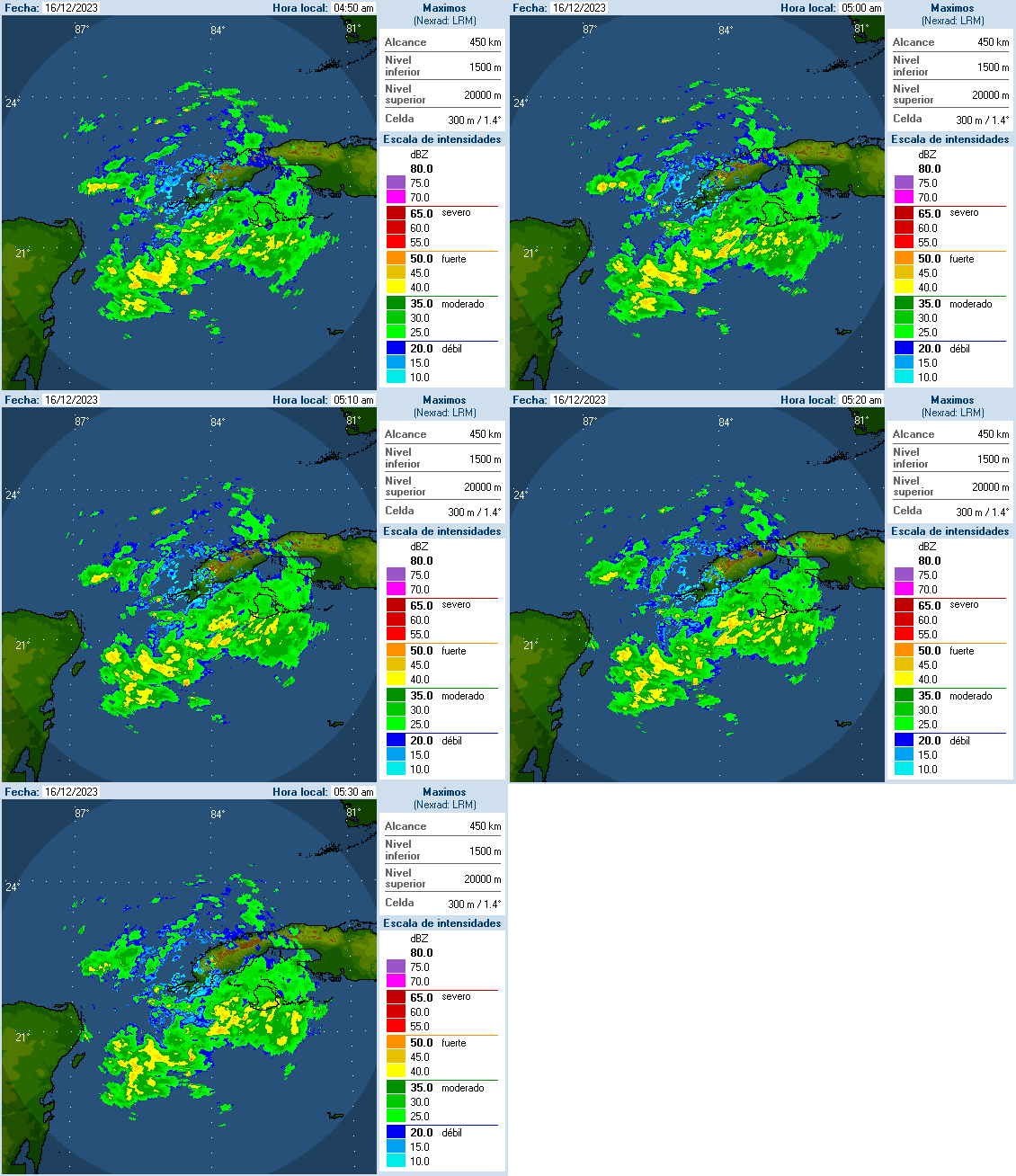
The Cuban Meteorological Institute issued Special Notice No. 1 on December 15 regarding deteriorating weather conditions on the island this weekend.
The note from forecast center Insmet details the rain, thunderstorms and coastal flooding that will impact the country starting today.
in it textWe point out that conditions are still favorable for the formation of an extratropical depression in the Gulf of Mexico in the next few hours, which will intensify rapidly, move northeastward towards the northern part of the Florida Peninsula and maintain its influence over the next few days around the clock. Western region of Cuba.
The wide circulation of this tropical depression will affect western Cuba starting today, Saturday the 16th, and will cause deteriorating weather conditions with showers, rain, electrical storms, and somewhat strong southerly winds, with speeds ranging between 20 and 35 kilometers per hour. , with higher gusts.
Light coastal flooding will also occur in low-lying areas of the southern coasts of the western governorates.
The frontal cloudy band will begin to affect the province of Pinar del Río and the special municipality of Isla de la Juventud from the early hours of Saturday morning, moving during the day across the rest of the western region and at night into the central region. With rain, rain and thunderstorms.
Weather in Cuba this weekend
According to forecasts, the rain could become strong and heavy in some locations, in addition to increasing the strength of the usual winds as they pass through rainy areas.
Water accumulation in coastal areas can increase the area of flooded areas, due to the combined effect of sea state and rainfall. The possibility of severe local storms is not excluded.
Later, the cold front will move east over the Gulf of Mexico, approaching the national territory, and will reach western Cuba during the early hours of Sunday. The combination of extratropical low pressure in the southeastern United States and high continental pressures is expected to generate strong northwesterly winds of 25 to 40 kilometers per hour, starting early Sunday, which will continue through Monday over the Gulf of Mexico and western Cuba.
This situation will cause strong waves on the northwest coast, with light to moderate coastal flooding in low-lying areas of this coastline, including the Havana seawall, starting on the morning of Sunday 17th.
The Meteorological Institute’s Forecast Center continues to closely monitor the development of this meteorological condition and a new special warning will be issued if necessary.

“Music buff. Social media lover. Web specialist. Analyst. Organizer. Travel trailblazer.”

:quality(85)/cloudfront-us-east-1.images.arcpublishing.com/infobae/TEQF6EONZRFGLLLDIDD4L2O4EE.jpg)

:quality(75)/cloudfront-us-east-1.images.arcpublishing.com/elcomercio/XU32LRAEZFDDPNVHLFU3CKVBYY.jpg)


More Stories
Sheinbaum, Galvez, Mainz campaign wrap-up, news and more
Sheinbaum and Mainz’s CDMX campaign wraps up: Road Alternatives and Street Closures
Ortega attacks Humberto Ortega and declares him a “traitor to the country”